The currently developing El Niño (2026) causes severe drought and fire risk in SE Asian and especially Indonesian peatlands. To help monitor this situation, we publish monthly updates of rainfall and water table depth in the region, following the method recently published in this paper (assuming undrained peatland conditions):
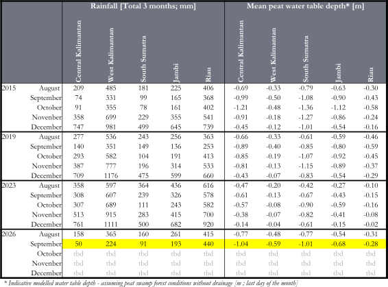
Below, we provide maps, summary graphs, and a table with monthly cumulative (3-month) rainfall and peatland water table depth in key regions.
By 30 September 2026, satellite rainfall and modelled peat water table depth (WTD) indicate conditions that are overall similar to the benchmark year of 2015, and in most peatland regions far drier than 2019 and 2023.
In Central Kalimantan and South Sumatra, the regions usually most affected by El Niño drought, indicative peatland WTD (assuming undrained conditions) by 30 September 2026 has dropped to –1.04 / -1.01 m, compared to -0.99 / -1.08 m in 2015. In Riau however, which has the greatest peatland area, water tables are high at -0.28 m, compared to -0.43 in 2015 and -0.59 in 2019.
Maps of (left) 3 monthly rainfall total and (right) modelled water table depth assuming undrained peat swamp forest conditions, by 31 August 2026:
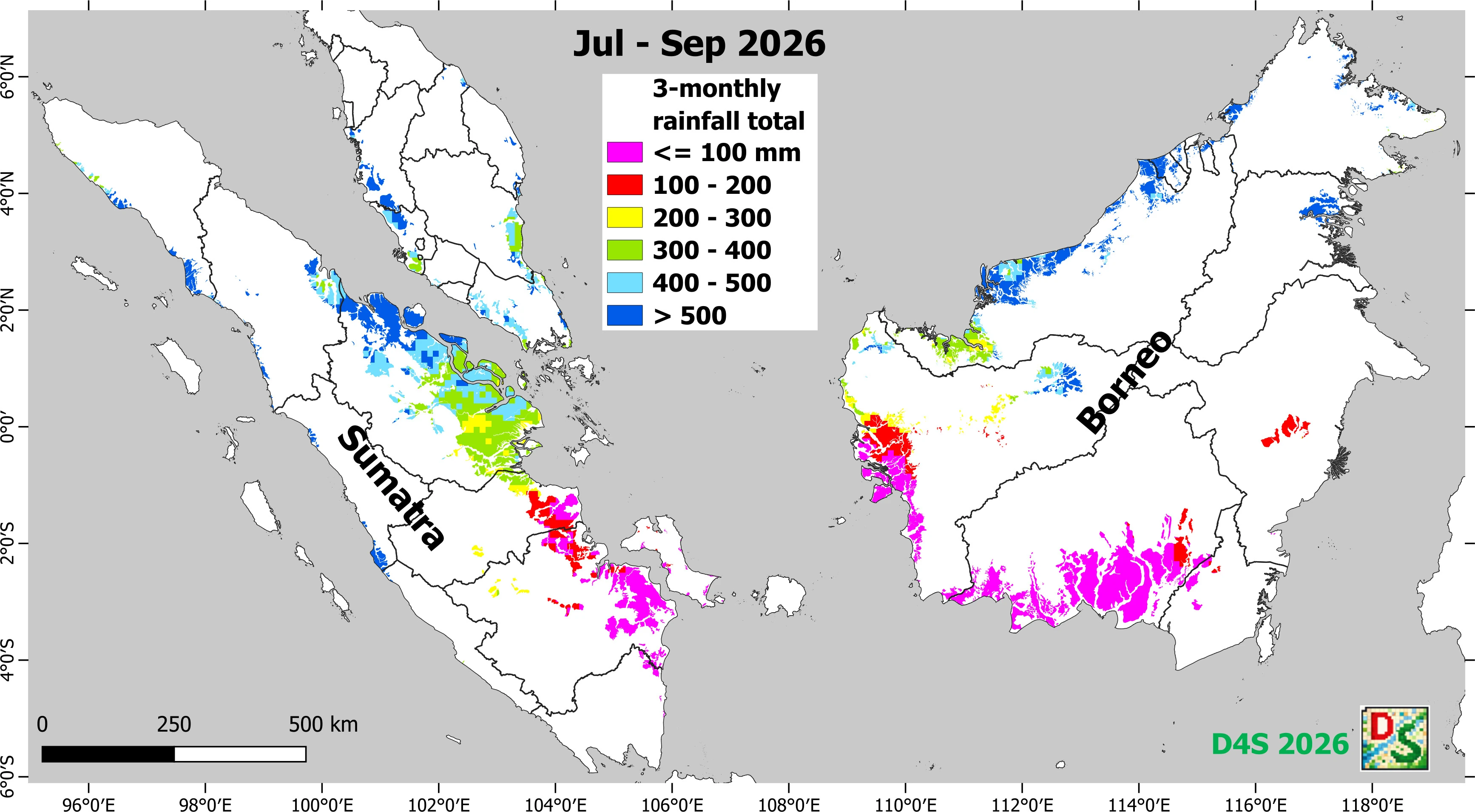
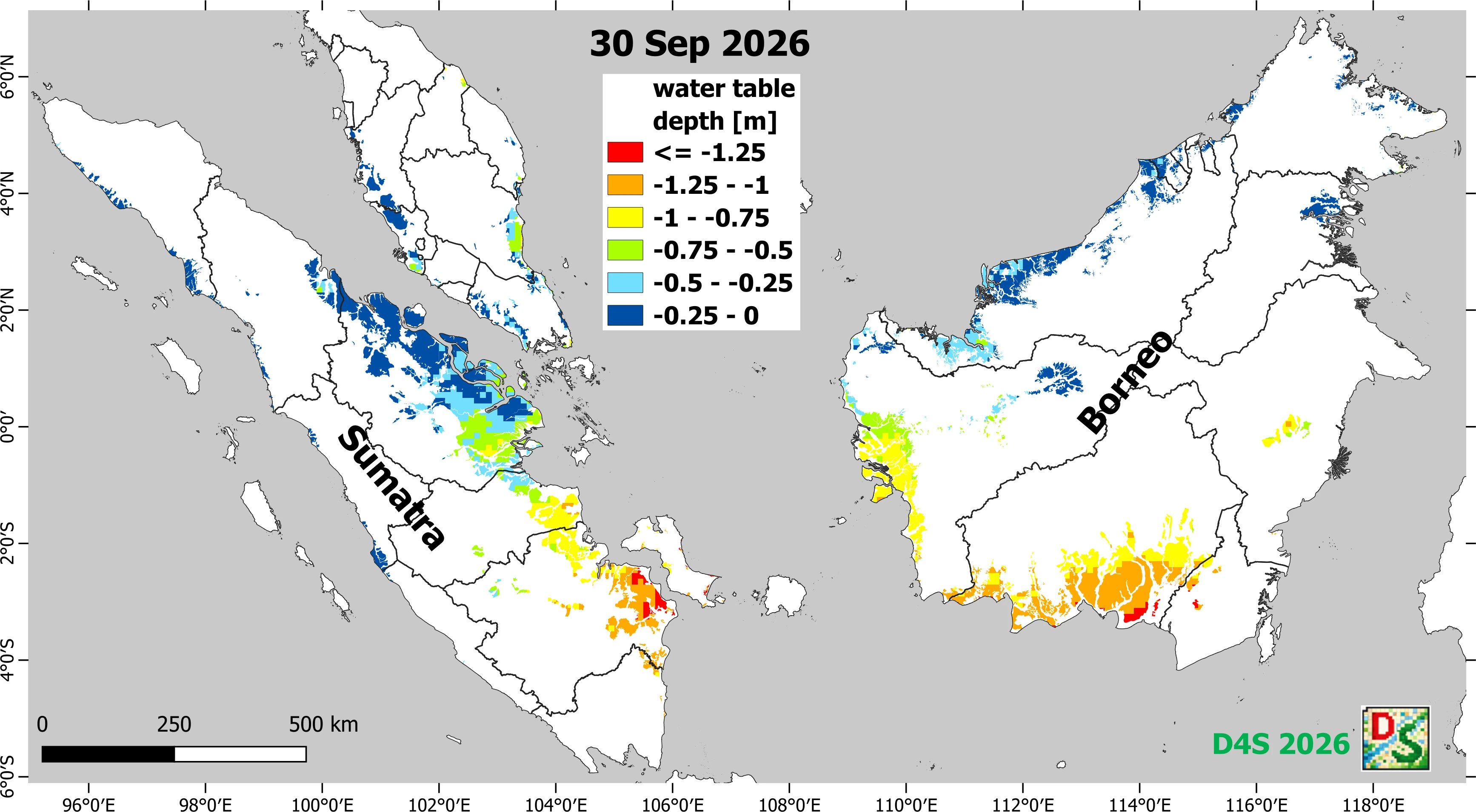
Monthly maps for 2026 and (for comparison) the 2015 El Niño year are shown HERE .
Time Series Graphs of Rainfall (Top) and peat water table depth (Bottom) for (left) Central Kalimantan and (right) South Sumatra for the 2015, 2019, 2023 and 2026 dry years:
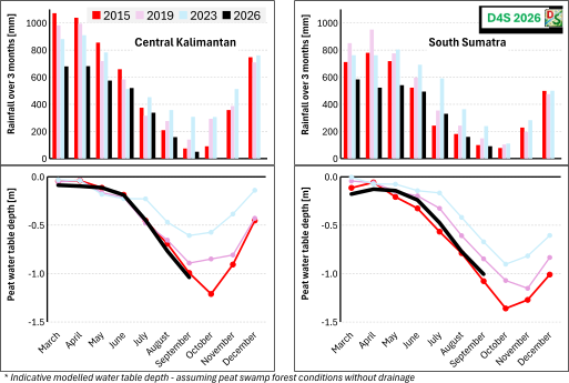
Table with further information on 3-monthly rainfall total and modelled water table depth for different regions and years: