September 2026
In response to the current El Niño conditions that bring rainfall drought, low peatland water levels and high fire risk to SE Asia, we placed a ‘SE Asia peatland drought monitor’ online:
Indonesia & Southeast Asia peatland El Niño drought monitor →
The monitor will be updated monthly. We hope this will be of use to researchers, peatland managers and policy makers, in following current developments and understanding the hydrological background of fire patterns.
August 2026
We are happy to announce two new papers that we produced to strengthen the science base for tropical peatland restoration, as well as scientific studies of peatland forest ecology, carbon emissions and fire risk.
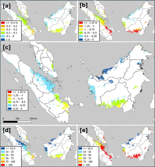
Modelling water table depth (WTD) variation in Southeast Asia forested peatlands using satellite rainfall data
Highlights:
- Rainfall and WTD varies greatly in undrained forested peatlands across the region. Mean annual minimum WTD for example varies from -0.3 m in Sarawak and Brunei to -0.9 m in Central Kalimantan and South Sumatra.
- The implication for restoration projects is that WTD targets and rewetting approaches should also vary regionally. And the question is, is it wise to always aim to raise water levels as soon and as much as possible, or should nature be allowed to find its own balance in accordance with ‘nature-based solutions’ concepts?
- The implication for scientific research is that WTD associated with carbon emission and ecological studies should be considered carefully – what truly represents a ‘natural’ peat swamp forest (PSF) reference ecosystem? It appears that some published PSF emissions may have been measured in drained peatlands.
- We also identify the distance to which drainage affects peat swamp forest water levels – within 1500 metres from canals the ecosystem should probably be considered to be at least ‘somewhat drained’.
Satellite LiDAR reveals patterns in water table depth and flood risk in SE Asia coastal lowland and peatland plantations
Highlights:
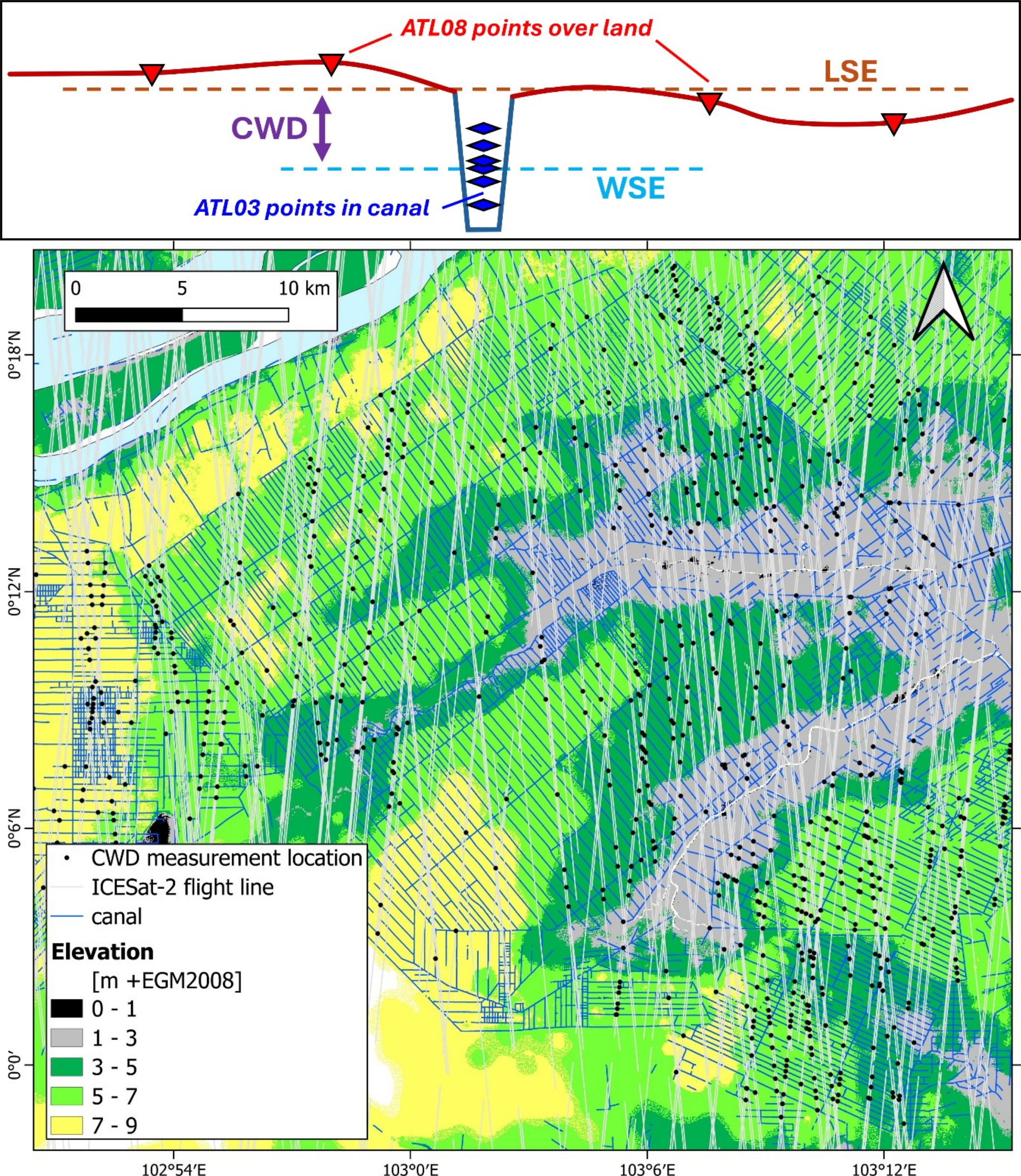
- Water table depths in industrial plantations are strongly affected by elevation above sea level – similarly across regions, crop types and soils (peatlands and mineral).
- Water levels at the lowest elevations confirm severe risk of flooding and production loss – this may mean that such plantations are sometimes not economically viable and could be prioritized for restoration to reduce emissions and enhance ecosystems.
- At higher elevations, mean oil palm and Acacia canal water table depths are -0.6 m and -0.85 m respectively, at the lower end of most management targets, confirming challenges in raising water levels in land far above the drainage base.
July 2026
AI is becoming an important factor in our work, but there are risks. Read a statement here on how we navigate these risks.
April 2026
We added Insight Reports, brief documents in which we explore important new developments in our work, and answer some frequently asked questions.
March 2026
Updated D4S website launched.