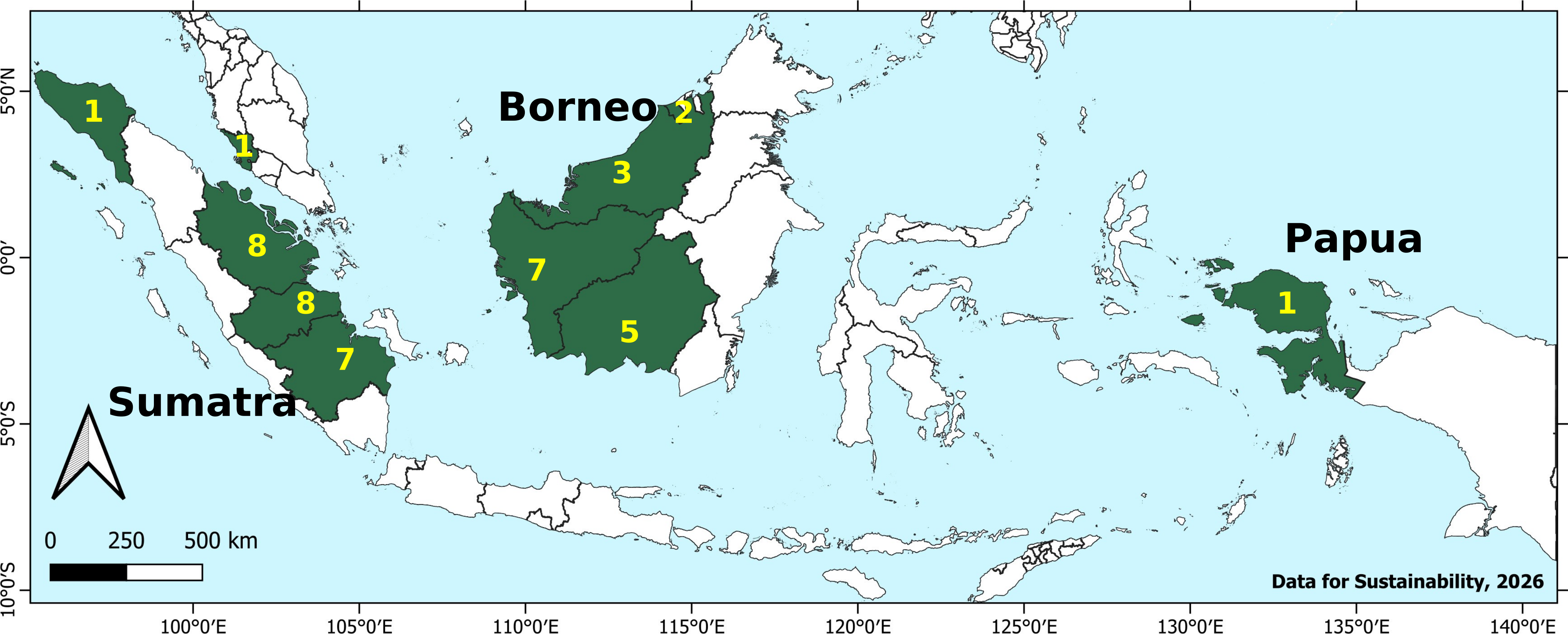
Overview map with locations where we worked on SE Asia Wetlands in our careers (number of projects indicated by Province / State; some projects in Singapore, Vietnam and Thailand not shown)
Recent Projects – Selection of projects and clients over the last 10 years (only large and publicly disclosed projects in SE Asia are shown)
Input to Project Development Document (PDD) development for a peatland restoration / conservation project in West Papua. Involves an elevation model, a peat thickness survey design, a peat thickness model, a peat carbon model, flood risk assessment, a drainage map, and model advice. Client: GHG Actions
Peatland Carbon Project Support (PCPS). Assistance in multiple plantations on peatland across Sumatra and Kalimantan: [a] Developing Peat Carbon Baseline (stock and emissions); [b] Review, analysis and quality improvement of datasets of water depth and surface subsidence; [c] Research and advice on rewetting methods that achieve both carbon emission reduction and forest restoration; [d] Support of water management monitoring and restoration operations on peatland. Client: Asia Pulp and Paper
Technical Assistance Study of Lowland Development and Peat Restoration – Strategic Irrigation Modernization and Urgent Rehabilitation Project (SIMURP). Measuring and mapping river and coastal water surface elevation for coastal lowlands across Sumatra and Kalimantan relative to local MSL and ground level, using satellite LiDAR data. With Deltares. Client: The World Bank
Katingan Mentaya project. Support for revision of the peatland emission reduction project's Baseline with an improved elevation model, peat thickness map, peat carbon map, drainage map, peat thickness survey design and supervision, model advice, and emission factors. Client: Permian
Research Support and Remote Sensing (RSRS) project, supporting the use of LiDAR data in plantation operations and research. Client: Asia Pulp and Paper
INTPREP project with the National University of Singapore. Developing, supervising, and reporting research with a focus on peatland functioning and restoration in Sumatra and Kalimantan. Aljosja Hooijer co-developed the project and was co-Principal Investigator; Ronald Vernimmen led on geospatial research. Funder: Temasek Foundation
Lowland Study project. Investigating past, current, and future flooding regimes in South Sumatra lowlands in the Musi Delta, as part of land suitability assessments with a focus on rice and oil palm agriculture, developing a new LiDAR DTM and accounting for different sea level rise scenarios. As Deltares. Funder: The World Bank
Peatland Best Practice Management Project (PBPMP). Assessment of conditions in Acacia plantations on peatlands across Sumatra and Kalimantan, including impacts on adjoining conservation forest and flood risk. Designed and supervised field and airborne LiDAR surveys across Sumatra and Kalimantan, and created elevation, peat, and flood risk maps with the resulting data. Recommendation of land use zoning and water management of plantations. Design and supervision of monitoring plans. Communication of results with stakeholders. As Deltares. Client: Asia Pulp and Paper
Brunei Assessment Project (BAP). Assessments of peatland carbon stock and emissions, as well as hydrological/subsidence monitoring and analysis and planning/supervision of hydrological rehabilitation through rewetting by canal blocking, for a peat dome that is affected by drainage. As Deltares. With Wetlands International, for Shell.
Sustainable Peatlands for People and Climate (SPPC). Improvement of peat maps for the Kampar Peninsula (Sumatra) and Rajang Delta (Sarawak); subsidence and flooding projections under different land use and climate change scenarios. The main aim is to quantify the loss of productive land that follows peatland drainage in the coming decades, and to raise awareness of this impact that has been overshadowed by carbon emissions and fire issues. As Deltares. With Wetlands International, for NORAD.